selected item
Article
Nanticoke
Article
About this website
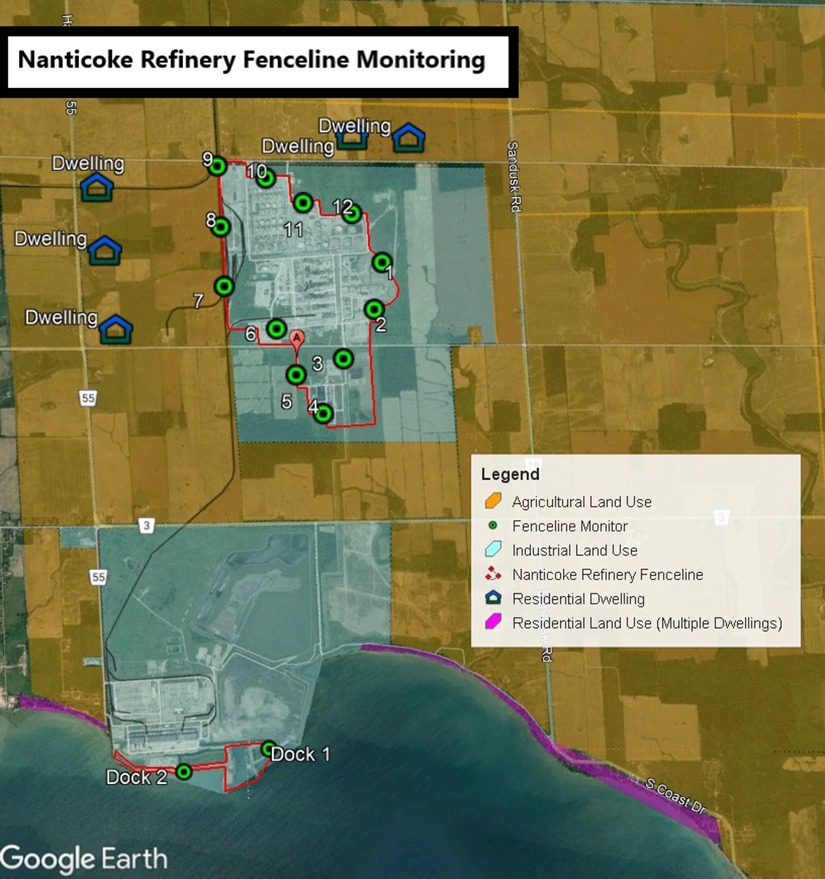
This website is an important step in increasing transparency with our neighbours, providing communities with:
- A map showing the location of each monitor and other relevant topographical information including any nearby water bodies, roadways and adjacent land uses.
- A table showing the information for each monitor for the calendar year and set out in a manner that can be understood by those without specialized scientific training.
Monitoring data is updated no later than 60 days after a two-week air sample is taken by a monitor.